
SETTLEMENT
Kulusuk
Quick facts about Kulusuk
Name (East Greenlandic):
Name (West Greenlandic):
Other names:
Population:
GPS coordinates:
Location:
Airport/Heliport:
Timezone:
Postal code:

A Remote Gateway to East Greenland
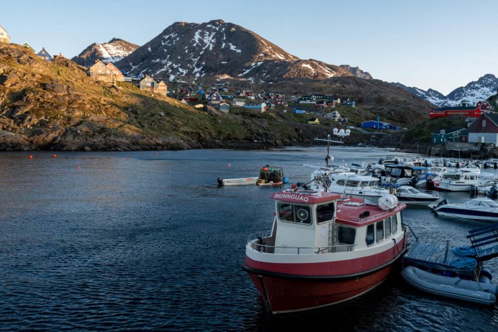
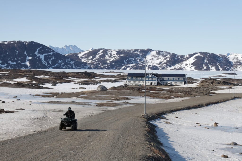
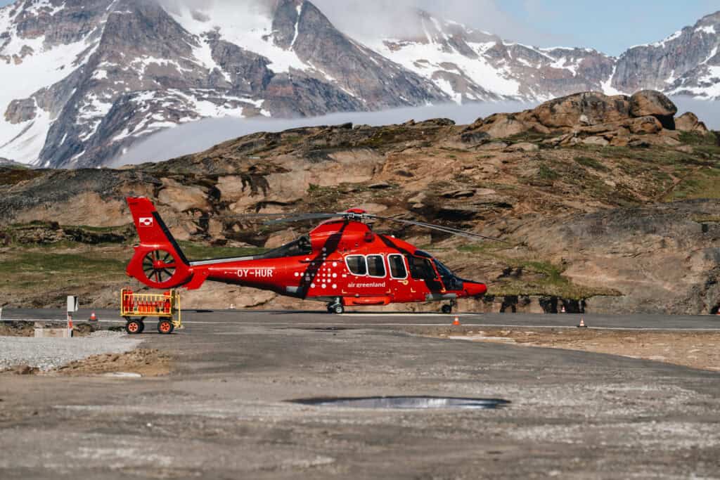
Kulusuk is a settlement in the Ammassalik region that is currently home to around 200 residents. Kulusuk Island, where the settlement is located, also houses the only international airport in the Ammassalik region, serving as one of the two gateways to East Greenland. Kulusuk Island has the longest gravel road in the area, as the gravel roads are established across the entire island connecting the settlement with the international airport as well as the radar location on the other end of the island.

Connecting Locally
While a permanent settlement at this location was established in 1909, Kulusuk island and thereby the settlement gained importance in 1956, when the US defense built the airport to support the Distant Early Warning Line station DYE4, which is located on the other side of Kulusuk Island. Still today, the international airport is the hub for accessing the Ammassalik region in East Greenland – international connections to Keflavik, Iceland, with only 1 hour 40 minutes flight time, as well as national connections to the capital Nuuk and helicopter connections to the town of Tasiilaq.


Basic Amenities Meet Nature’s Majesty
Being a small settlement, the facilities in Kulusuk cater to its residents’ needs. A multi-purpose approach to several facilities ensures that the inhabitants have access to basic facilities and infrastructure for their everyday life. Most importantly for locals and visitors alike is the close proximity to astonishing nature that lays just beyond the settlement.
Map of Kulusuk

Explore the heart of East Greenland with our detailed Kulusuk map. Perfect for framing or as a travel companion, our illustrated maps will become your go-to guide!
Map of the Ammassalik Region
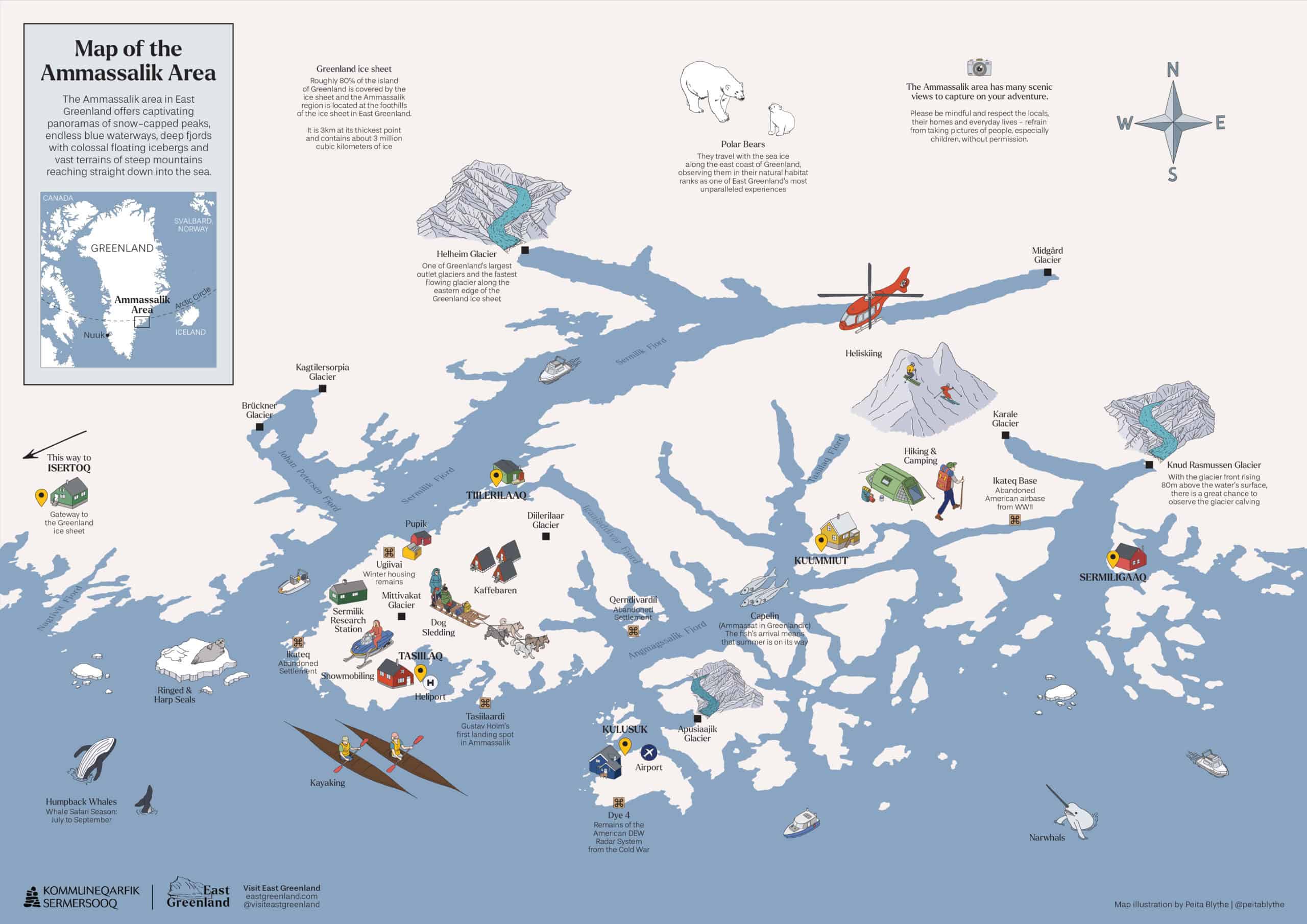
This map offers an expansive view of the region, helping you to plot your adventures and immerse yourself in the vastness and beauty of East Greenland.
Key Infrastructure in Kulusuk
- International airport that operates helicopter flights to Tasiilaq and national departure to Nuuk as well as international departure to Iceland
- A harbour with local pontoon in the settlement, as well as a tourist pontoon close to the airport, for boat connection to Tasiilaq or the other settlements in the area
- A small supermarket that includes local Greenlandic bank and post office
- A service house with running water that offers laundry and shower services
- A petrol station that is managed by the supermarket and petrol must be purchased at the supermarket counter during their normal opening hours
- Water supply: Across the settlement there are small blue huts for collecting drinking water
- A nursing station that must be contacted for all medical inquiries
- Recreational facilities such as multipurpose football field
Places to Visit in Kulusuk

Museum
A small but cosy family-style museum, where visitors can learn about the region’s traditions, arts, and history. Even if it is small, it hosts a substantial number of artefacts that come to live through the owner’s vivid storytelling. You need to contact the owners Justine and Frederik Boassen to arrange a visit.

DYE 4
Historic site from the US from the cold war. The station ‘DYE4’ as part of the US Distant Early Warning Radar Line System is located on a mountain at the southern end of Kulusuk Island overlooking the Atlantic Ocean, roughly 329 meters above sea level. The same site was used already by the US during world war II as a weather station. While the DYE4 station was closed in 1991, the remains stand, the view alone is worth a visit.

Church
The church was constructed around 1922 by the crew of a Danish fishing vessel that was stranded close to the settlement and used the timbers from the ship to construct the main building. It’s simple look from the outside, has a very colourful insight. To date, a replica of the ship it was built from, hangs from the ceiling. The elegant geometric stained glasses have been donated by a German glasswork owner that fell in love with the place. The colourful inside has many small Greenlandic details woven into it, such as seal skin around the altar.
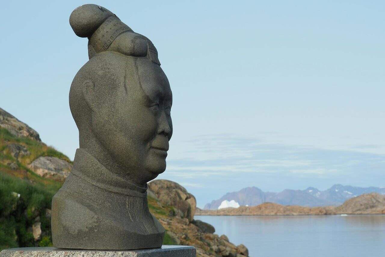
Statue of Drum Dancer
On the outskirts of the settlement, beyond the church, right next to the shore, is the statue of the late Milka Miilikka Kuitse, representing her resistance to the drum dancing culture. During the early colonial period in East Greenland, drum dancing was forbidden by the missionaries, however she fought to preserve this important tradition and continued drum dancing. To this date, drum dancing serves an important role in specific cultural settings, which her statue reminds us of.
Accommodation in Kulusuk

Pirhuk

Tunu Explorers East Greenland
Arctic Wonderland Tours
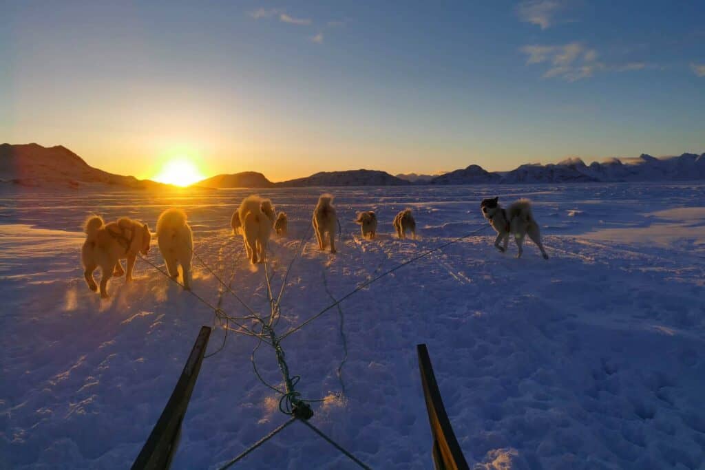
Kiijali East Greenland Dog Sledding
Providers in Kulusuk
Kiijali East Greenland Dog Sledding
Arctic Wonderland Tours
Nunatak Adventures
Pirhuk
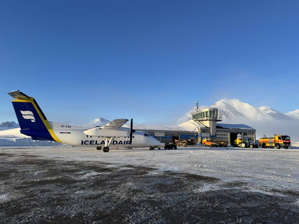
Icelandair
Kulusuk Tours
Air Greenland
Articles about Kulusuk
Exploring East Greenland’s Icy Beauty with Film Photography
Escape the Digital World

Wilderness ski touring and exploration in East Greenland

A 7-Day Summer Itinerary Through East Greenland
Kulusuk – a rugged gateway to the Arctic
Photo – Filip Gielda, Visit East Greenland
Plan Your Trip
Plan your East Greenland adventure, tapping into local knowledge, expert tips, and essential planning tools.
Towns & Settlements
Explore East Greenland’s quaint towns and remote settlements, discovering unique landscapes, rich culture, and rugged Arctic beauty.
Tour Providers
Once you’ve chosen your adventure, book your East Greenland journey through local operators or plan it independently.
Articles
Read through our curated articles about East Greenland, deepening your insight into its seasons, traditions, and wonders.
Resources
Discover East Greenland’s essential resources and planning tools, ensuring deeper insights, trusted guidance, and a fulfilling adventure.