
Maps of East Greenland
Photo: Marek Micanek – Visit East Greenland
East Greenland is a vast, rugged landscape – beautiful, remote, and often unmapped in the conventional sense. We’ve gathered the best available maps, from hand-drawn illustrations to online GIS tools, to help you explore the region with clarity and confidence.
Here you’ll find detailed overviews of towns, settlements, and natural landmarks, alongside links to interactive resources and places to buy physical maps. Whether you’re planning a trip or just curious, this is your guide to finding your way in East Greenland.
Overview & Shortcuts
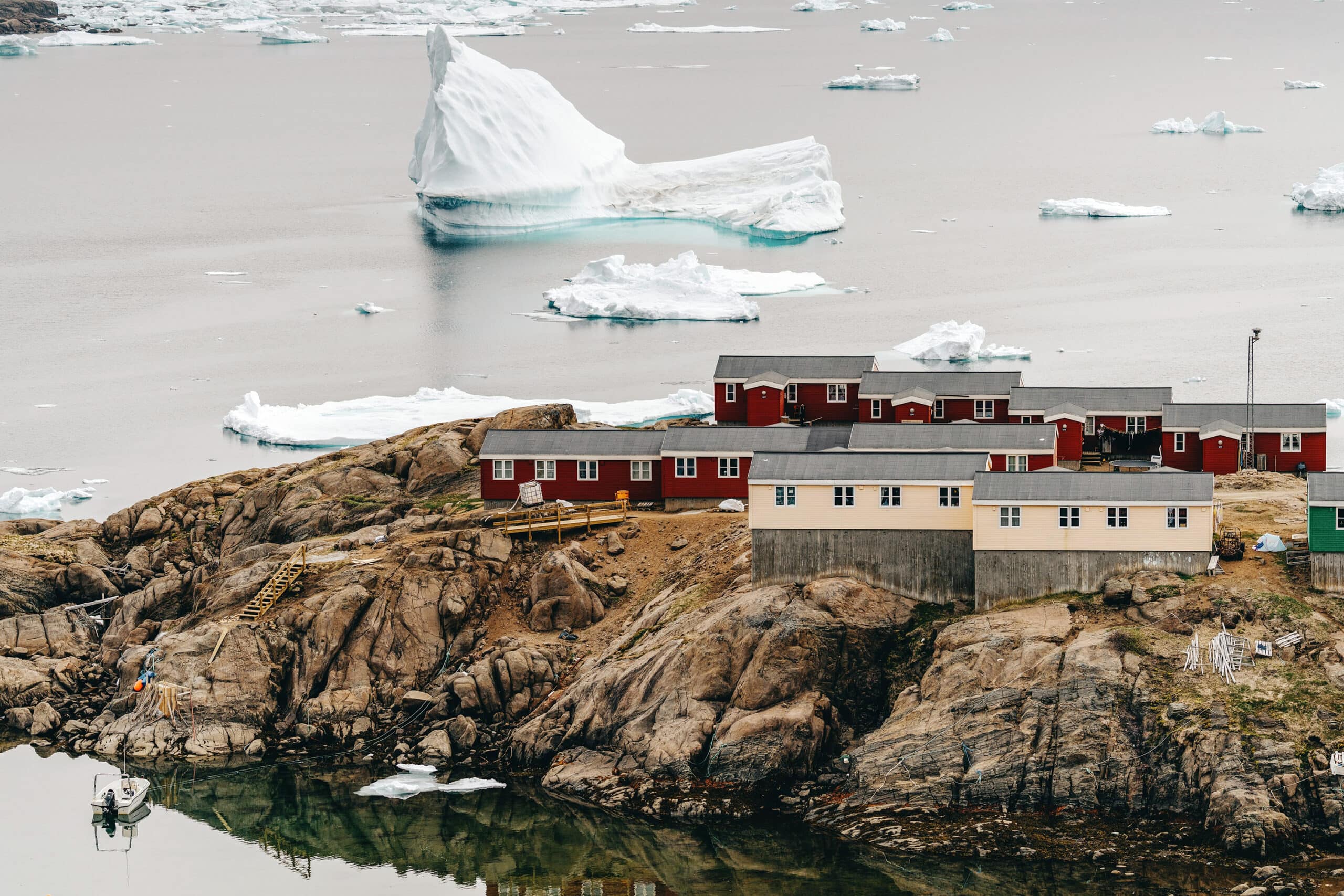
A quiet village at the edge of the world. Maps lead here – stories begin here.
Photo – Emmett Sparling, Visit East Greenland
Illustrated Maps
Illustrated Maps by Visit East Greenland – hand-drawn with care, our illustrated maps offer a personal and accessible view of the region.
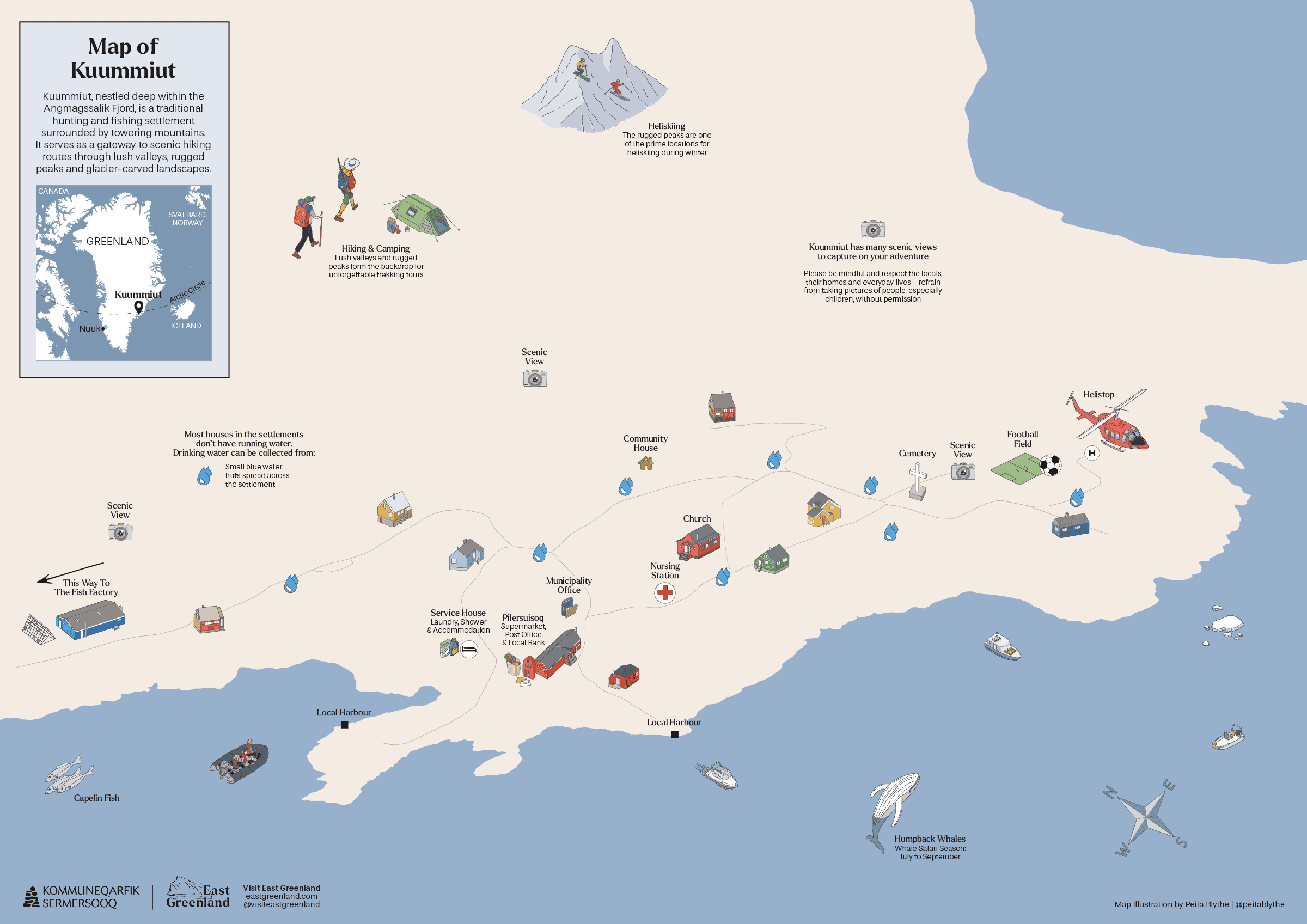
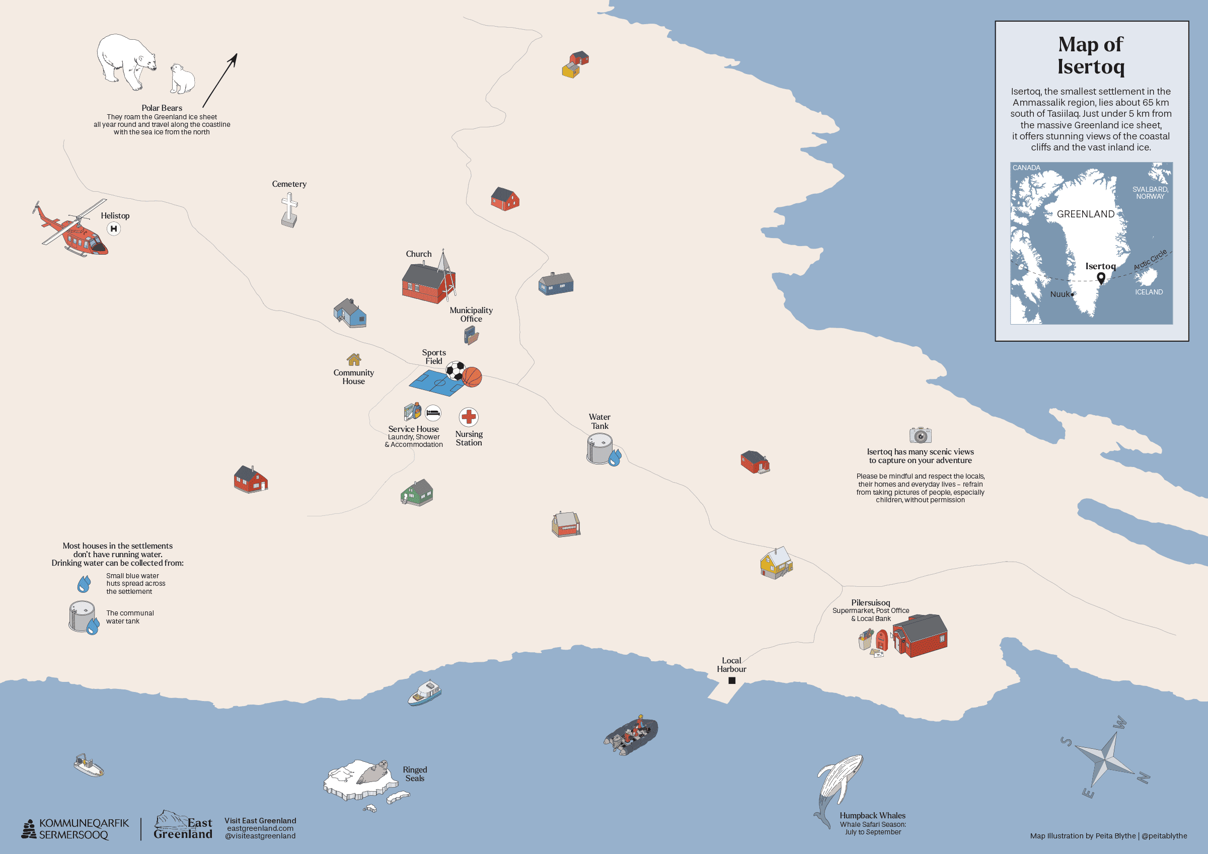
Regional Overview: Ammassalik
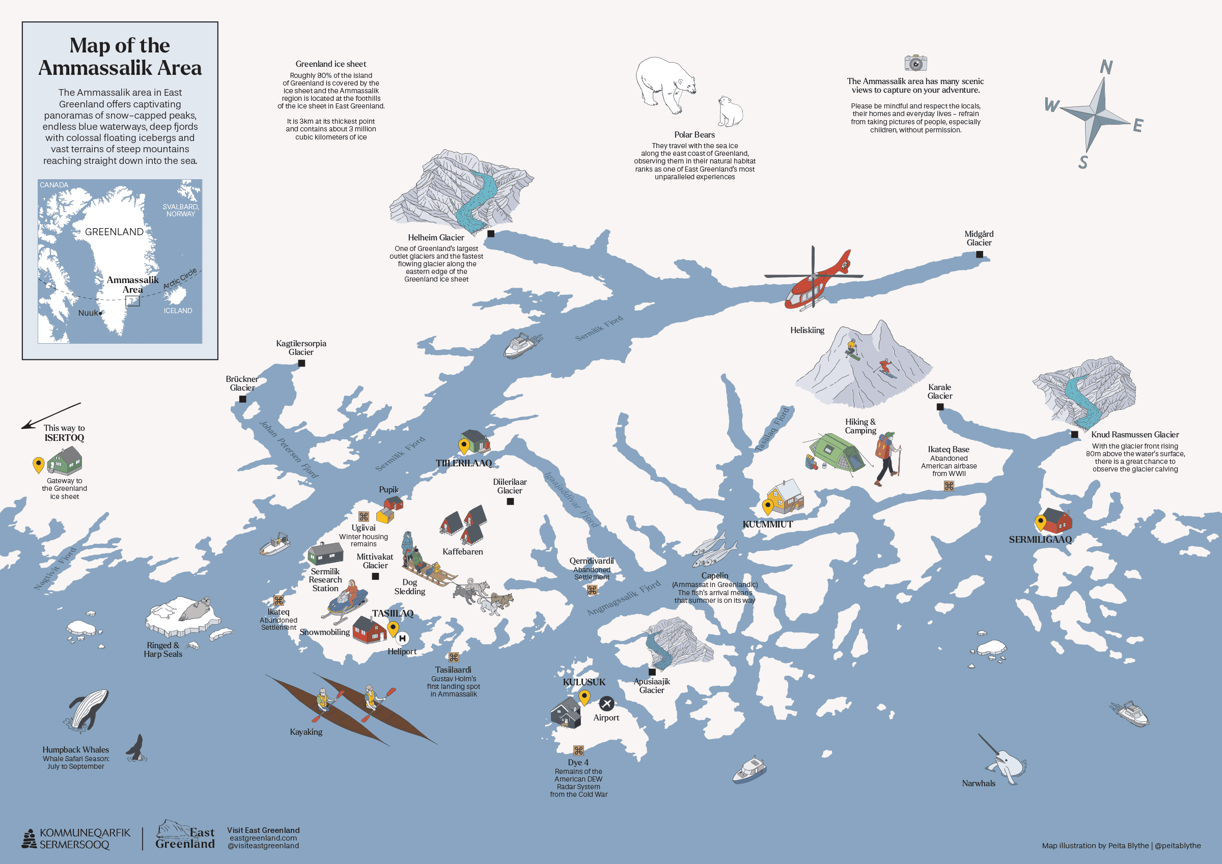
Ammassalik
Region
Broaden your horizons with our regional map. From the sprawling glaciers to the intricate fjord systems, get a panoramic view of East Greenland’s breathtaking landscapes.
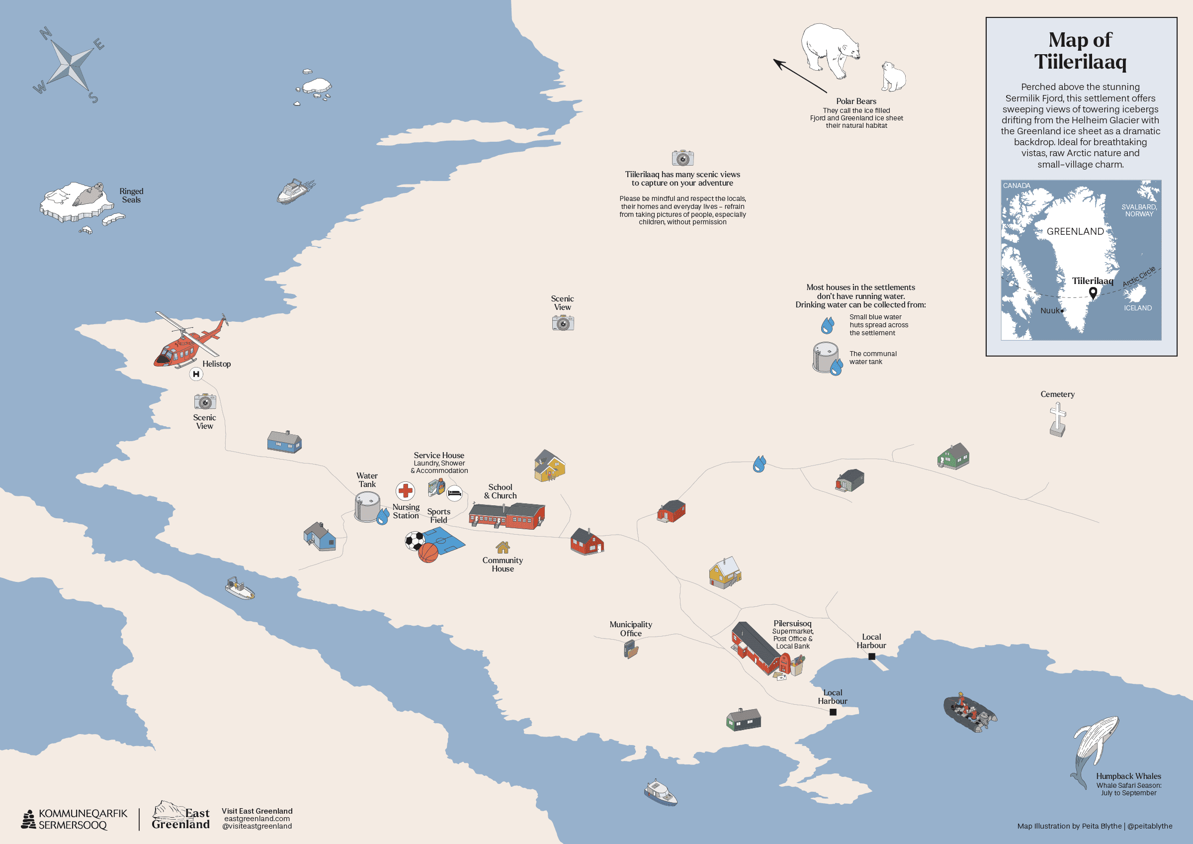
Ammassalik Region: Towns & Settlements

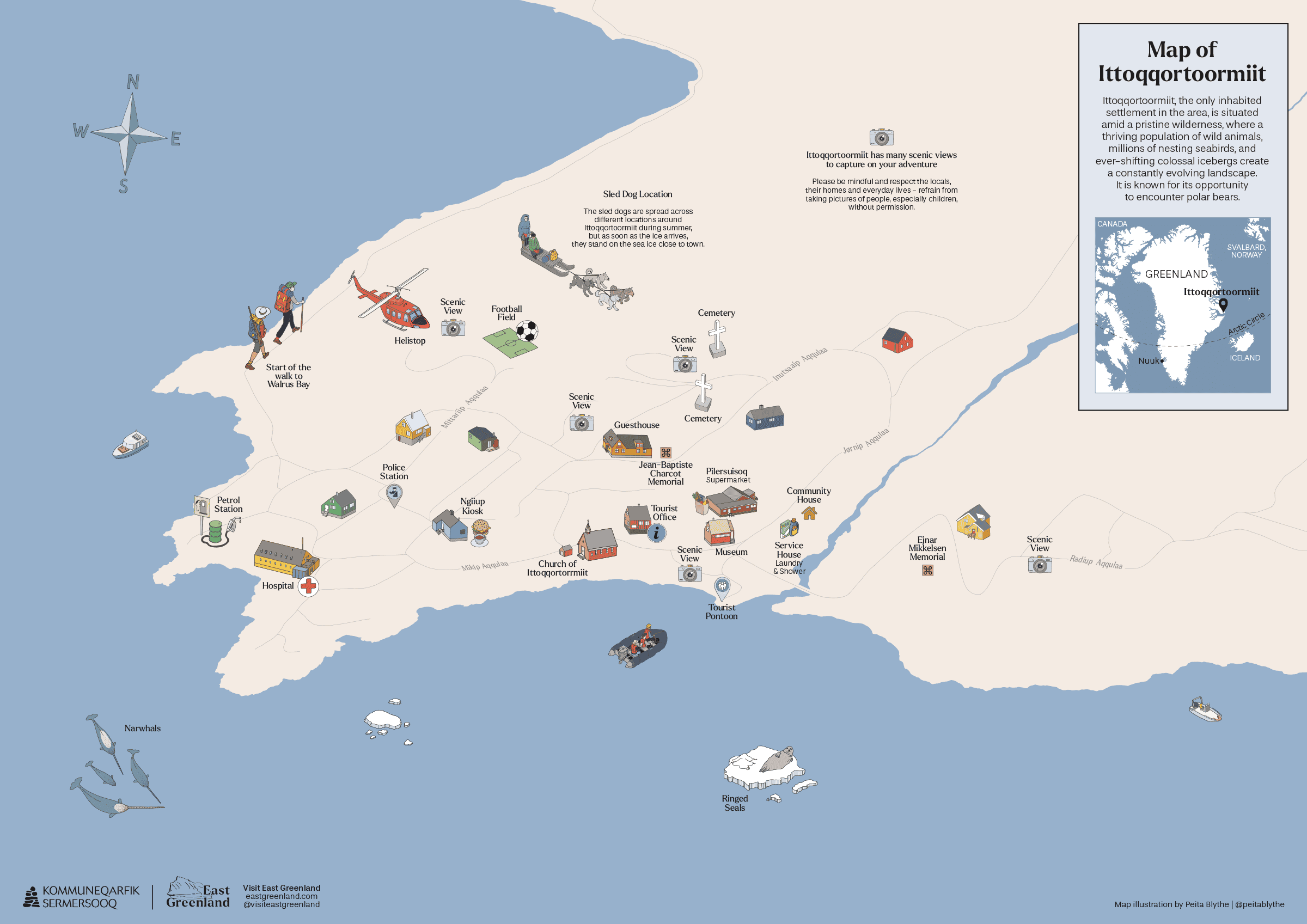
Regional Overview: Ittoqqortoormiit
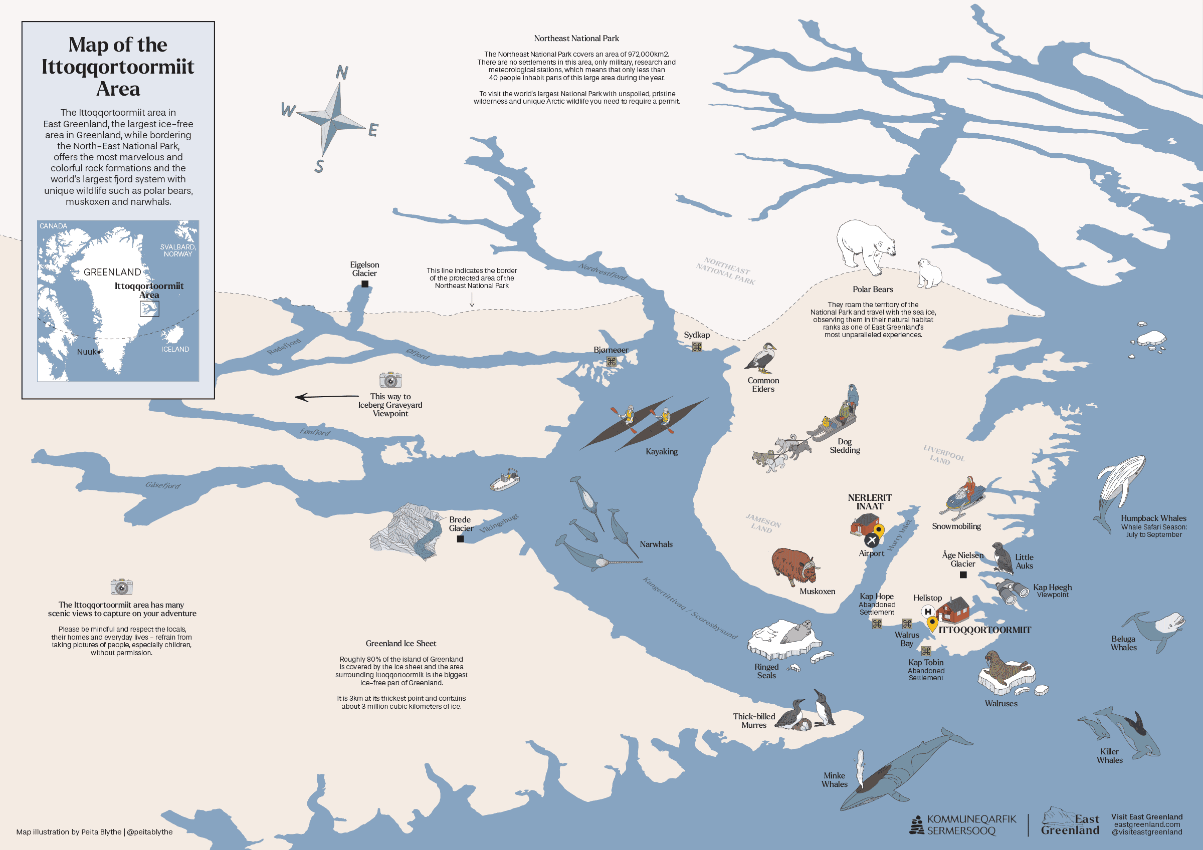
Ittoqqortoormiit
Region
Broaden your horizons with our regional map. From the sprawling glaciers to the intricate fjord systems, get a panoramic view of East Greenland’s breathtaking landscapes.
Ittoqqortoormiit Region: Towns & Settlements
Roads curve with the land. Life maps itself in colours and corners.
Photo – Oscar Scott Carl, Visit East Greenland
Topographic Maps
Detailed, downloadable topographic maps based on data from the Danish Agency for Data Supply and Infrastructure offer a clear, zoomable overview of the region’s terrain, settlements, and natural features. You can explore and download these maps via Dataforsyningen.dk (in Danish only), the official platform for geographic data in Denmark.
Regional Overview: Ammassalik

Ammassalik
Region
A new, up-to-date topographic map of the entire Ammassalik region, allows you to get a panoramic view of Ammassalik’s breathtaking landscapes and zoom in on glaciers, endless fjords and jagged mountains.

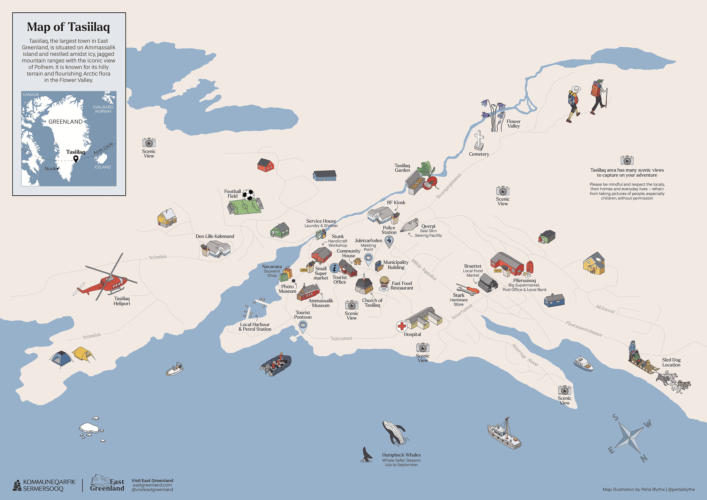
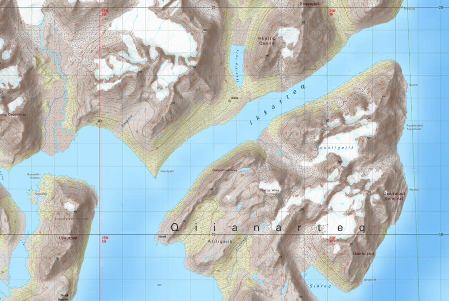
Tasiilaq
Town | Map No. 2823-3
Have a closer look at the terrain surrounding Tasiilaq on Ammassalik Island. Here, you can find all relevant information about the terrain, elevation, and place names to navigate your visit to the biggest town in East Greenland and Ikateq – the Abandoned Settlement.
Towns & Settlements

Kulusuk (I)
Town | Map No. 2823-2
Points of interest: Ammassalik Island; Kulusuk Island, Apusiaajik Glacier; Qernertivartivit


Regional Overview: Ittoqqortoormiit
Ittoqqortoormiit
Region
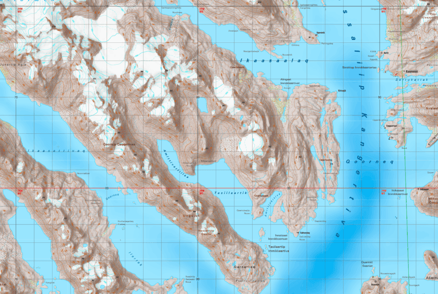
This regional map covers around 38,000 km² for you to explore, which is the natural habitat to an abundance of wildlife from polar bears and muskox to different whale species and walruses.

Ittoqqortoormiit
Town | Map No. 4132-1
With this map, you can zoom in on one of the most remote towns in Greenland. Explore the terrain and shapes of the land beyond the small town’s limits, giving you up-to-date details about the present topography. Point of interest: Kap Tobin
Ittoqqortoormiit Region: Towns & Settlements

Not all landscapes fit on paper. Some are meant to be felt.
Photo – Oscar Scott Carl, Visit East Greenland
Other Map Resources
A selection of interactive tools and external resources to support your map-based planning and exploration of East Greenland. From digital place-name registers to 3D settlement models and Google MyMaps, these sources complement our illustrated and topographic maps with layers of practical and cultural insight.
Viewpoints of Tasiilaq
by Visit East Greenland
Discover the best scenic viewpoints in and around Tasiilaq with our custom Google MyMaps guide, curated by Visit East Greenland. Whether you’re looking for dramatic mountain vistas, quiet coastal spots, or perfect photo stops, this interactive map helps you find your way to the most breathtaking views in the area.
See East Greenland Through Time
Explore how East Greenland’s landscapes have changed over the years with Google Earth’s Historical Imagery feature. From retreating glaciers to shifting coastlines, this tool lets you scroll through satellite images from past decades and see nature in motion.

Maps guide. But in East Greenland, ice and colour do the talking.
Photo – Anna & Lucas Jahn, Visit East Greenland