

SETTLEMENT
Nerlerit Inaat
Quick facts about Nerlerit Inaat
Name (East Greenlandic):
Other names:
Population:
Location:
GPS coordinates:
Airport/ Heliport:
Timezone:
Postal code:

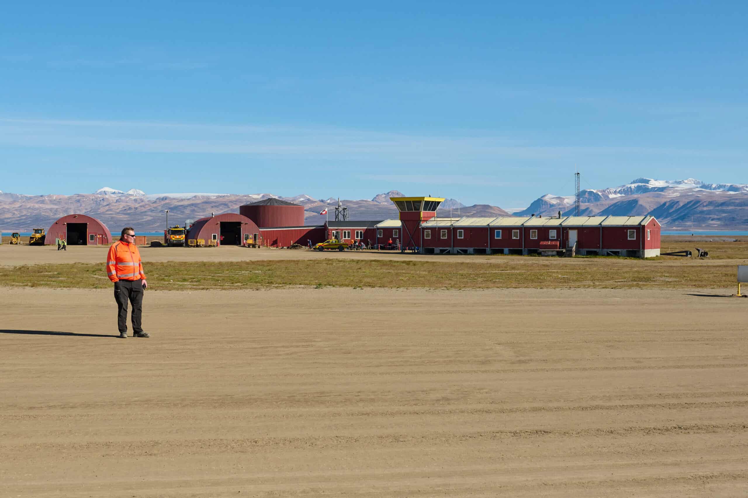
The Unassuming Hub
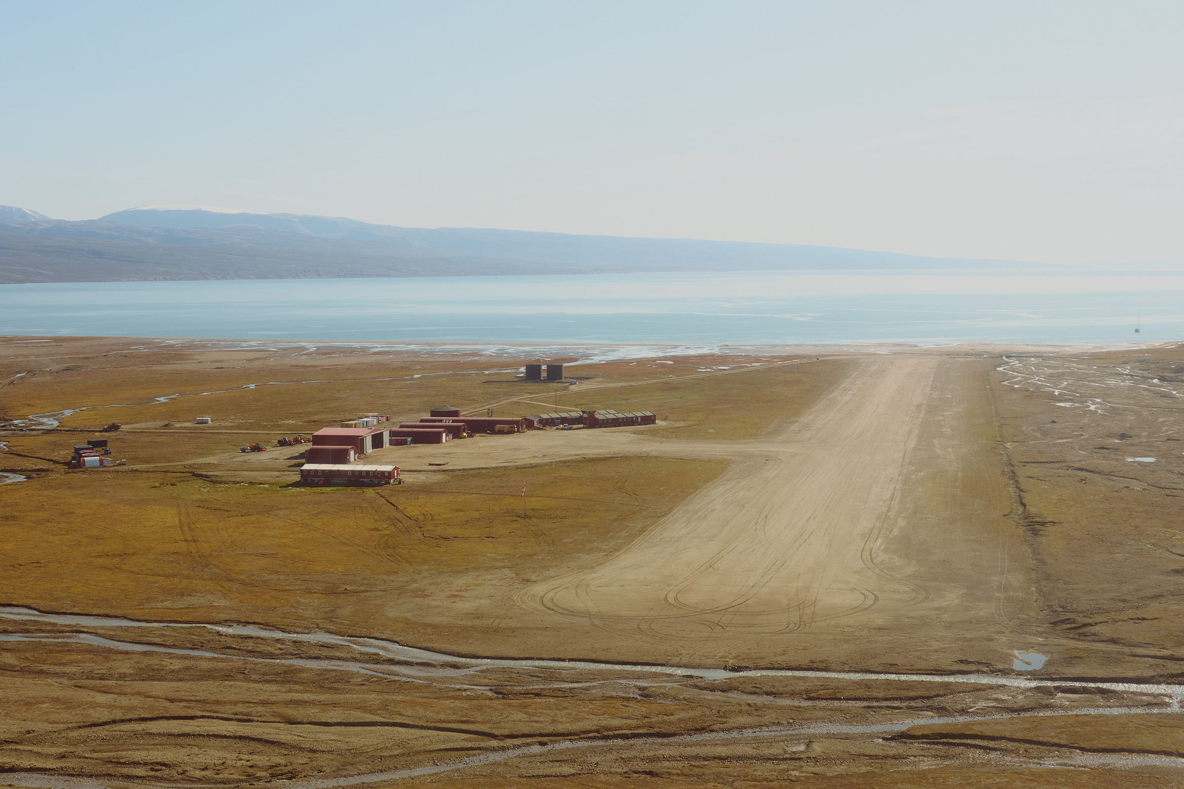
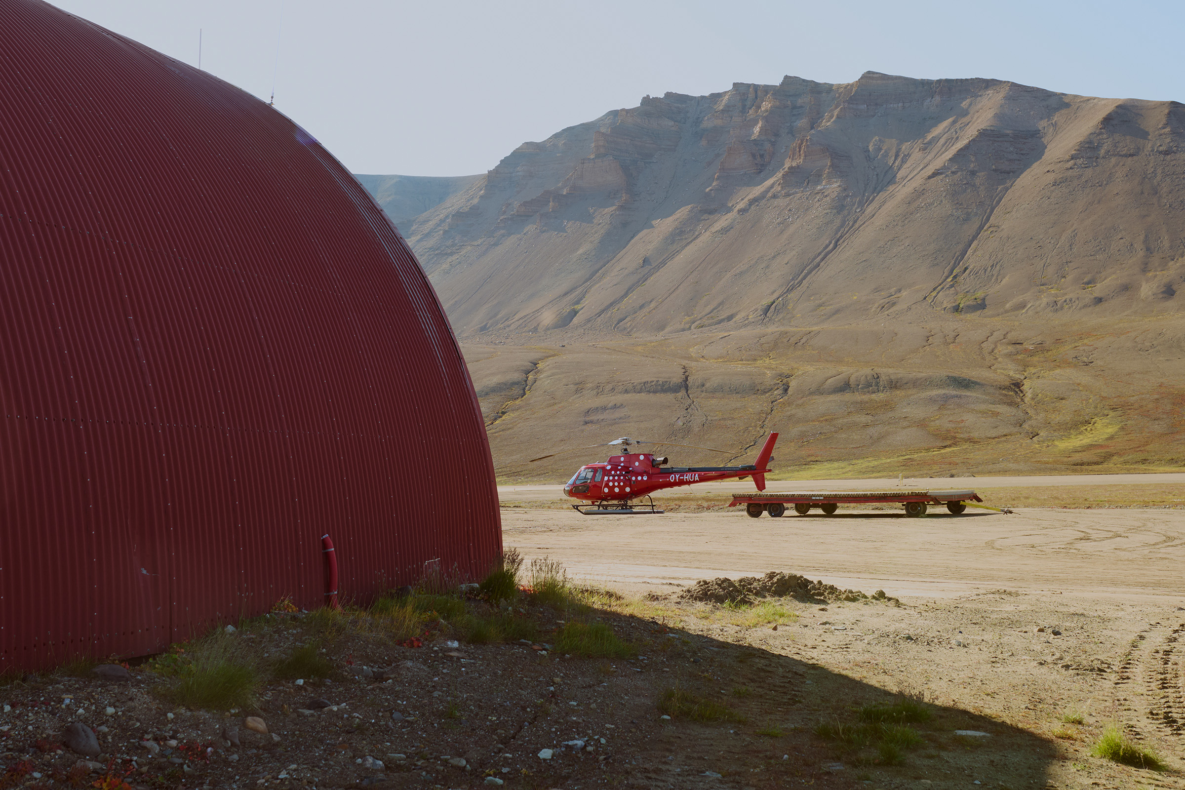
Situated on the rugged terrains of Jameson Land lies a small yet strategically important international airport Nerlerit Inaat. Operating year round with two international connections per week to Iceland, this airport serves as the hub to visiting Ittoqqortoormiit, which is only a 10 minute helicopter ride away. From the airport a 2 kilometer gravel road connects to a small port in the Hurry Inlet, which can be used for boat transfer during summer, while during winter a snowmobile ride would be an alternative to the helicopter to reach Ittoqqortoormiit.
Connecting Internationally
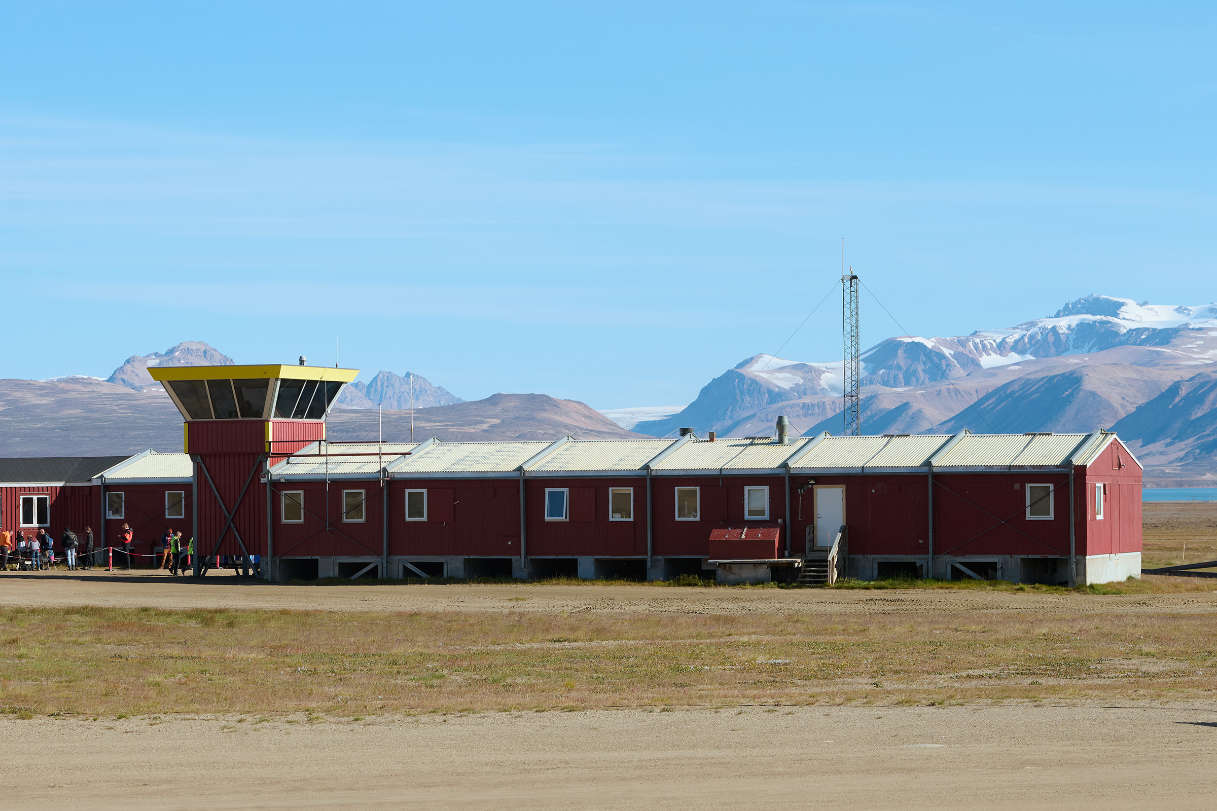
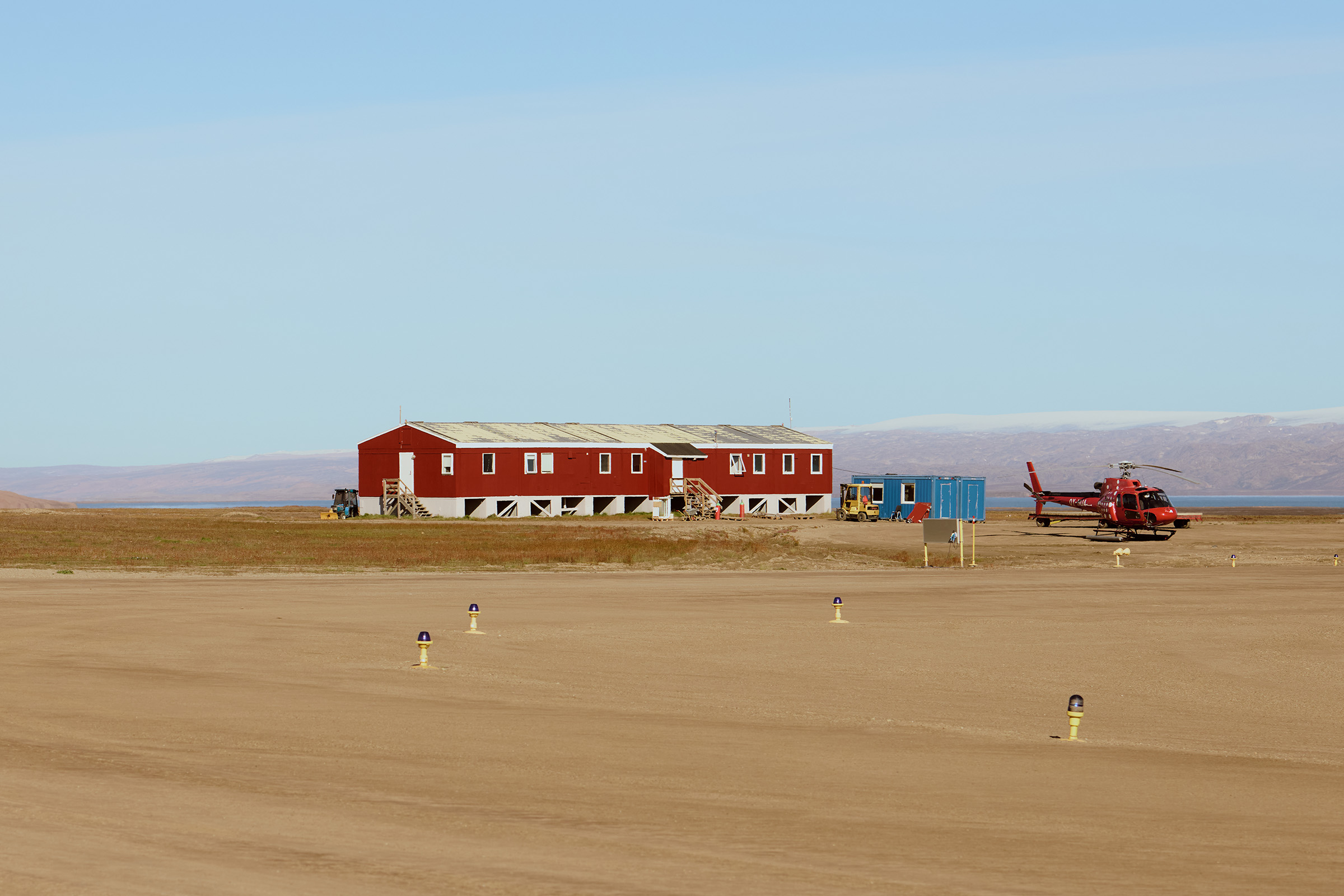
Nerlerit Inaat might be small with its modest terminal and few additional buildings and hangar, yet its importance far outweighs its physical footprint. Built in 1985 by the US oil company ARCO for the oil exploration in James Land at that time, it was sold to Greenland a few years later. It is the only stopover to reach Ittoqqortoormiit, making it a key touchpoint in the remote region’s transportation network. Mittarfeqarfiit also owns the only overnight accommodation with 8 rooms at the airport, which caters for any stranded passengers. Situated just at the edge of the airstrip, this establishment offers a unique experience, an overnight stay in the middle of nowhere, surrounded by the immense Greenlandic landscape.

A Remote Haven in the Wilderness of Jameson Land
Nerlerit Inaat is set in one of the most remote regions of Greenland, with breathtaking views of the surrounding wilderness. The landscape is marked by vast, windswept tundra, towering mountains, and the pristine, untouched beauty of Jameson Land. Jameson Land is home to some of Greenland’s most unique and diverse wildlife, including musk oxen, Arctic foxes, and a variety of bird species. The serene isolation of Nerlerit Inaat makes it an ideal place for those seeking quiet and solitude in nature.
Map of Ittoqqortoormiit

This vibrant settlement of 363 residents offers rich experiences and warm hospitality. The map highlights the helistop, essential amenities, and local charm connecting it to the world.
Map of the Ittoqqortoormiit Region

Covering 38,000 km², this region teems with wildlife—polar bears, walruses, and diverse birds. The map unveils rugged mountains, icy fjords, historic sites, and remote Arctic beauty.
Key Infrastructure in Nerlerit Inaat
- International airport with a helicopter connection to Ittoqqortoormiit and international connection to Reykjavik, Iceland
- Accommodation ‘Hilton-1 star’ owned by Greenland Airports (book by sending this request from to bookingcnp@airports.gl)
Articles about Nerlerit Inaat

Escape the Digital World
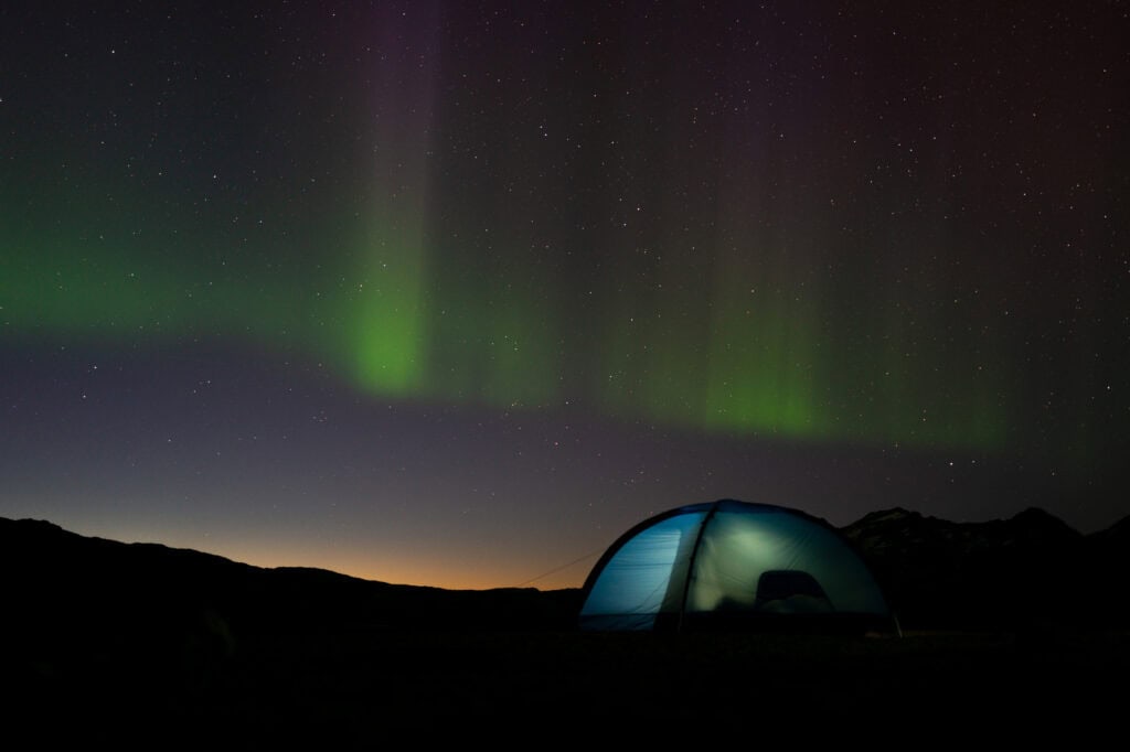
Discovering the Northern Lights of East Greenland

Season Swap in East Greenland
Plan Your Trip
Plan your East Greenland adventure, tapping into local knowledge, expert tips, and essential planning tools.

Towns & Settlements
Explore East Greenland’s quaint towns and remote settlements, discovering unique landscapes, rich culture, and rugged Arctic beauty.
Tour Providers
Once you’ve chosen your adventure, book your East Greenland journey through local operators or plan it independently.
Articles
Read through our curated articles about East Greenland, deepening your insight into its seasons, traditions, and wonders.
Resources
Discover East Greenland’s essential resources and planning tools, ensuring deeper insights, trusted guidance, and a fulfilling adventure.