
SETTLEMENT
Sermiligaaq
Quick facts about Sermiligaaq
Name (East Greenlandic):
Name (West Greenlandic):
Population:
GPS coordinates:
Location:
Airport/Heliport:
Timezone:
Postal code:

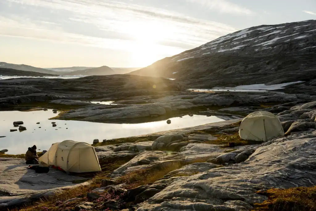
A Close-Knit Community Living in Harmony with Nature
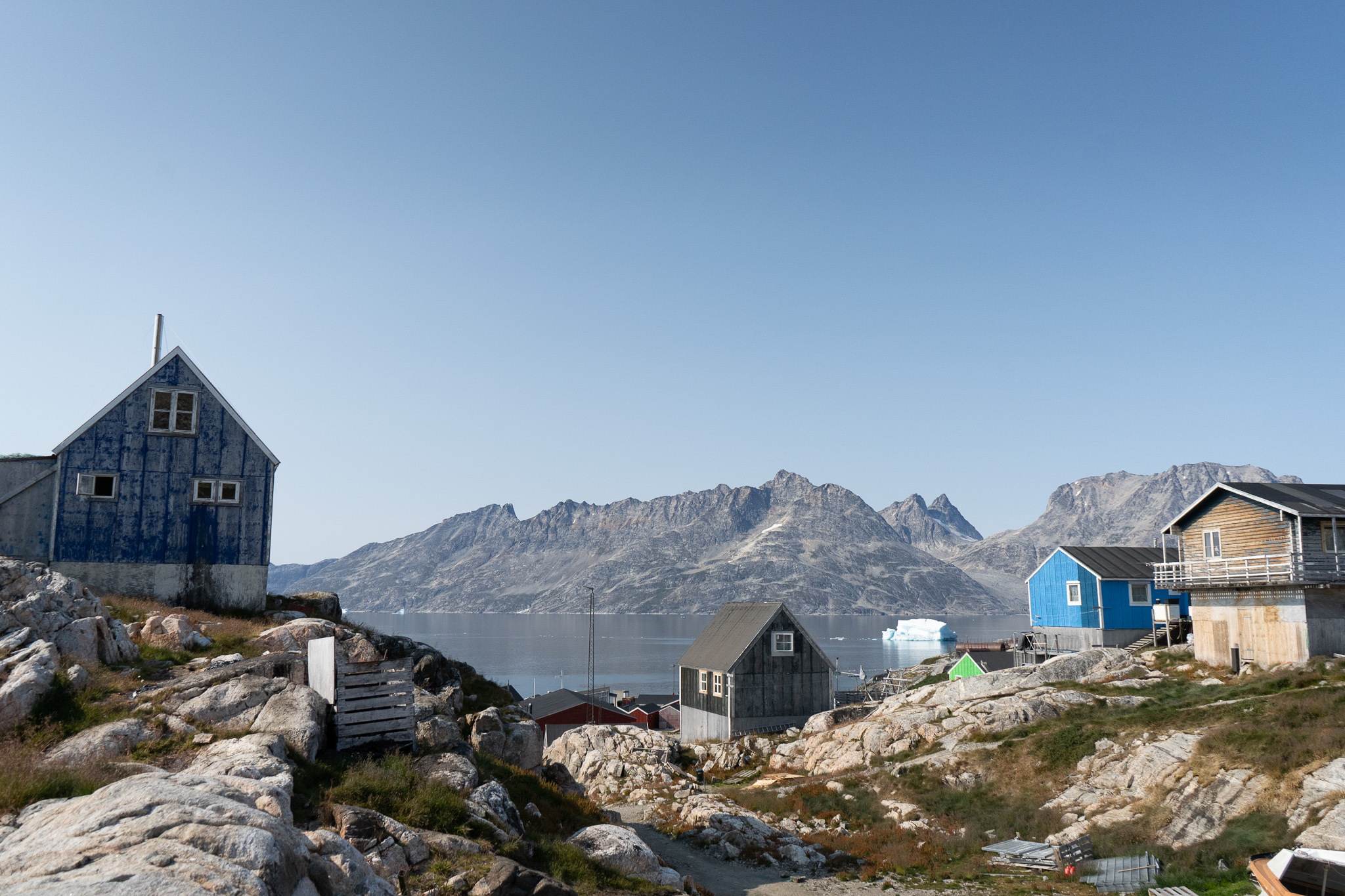
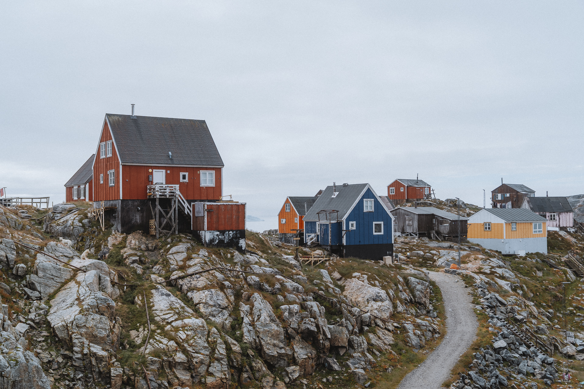
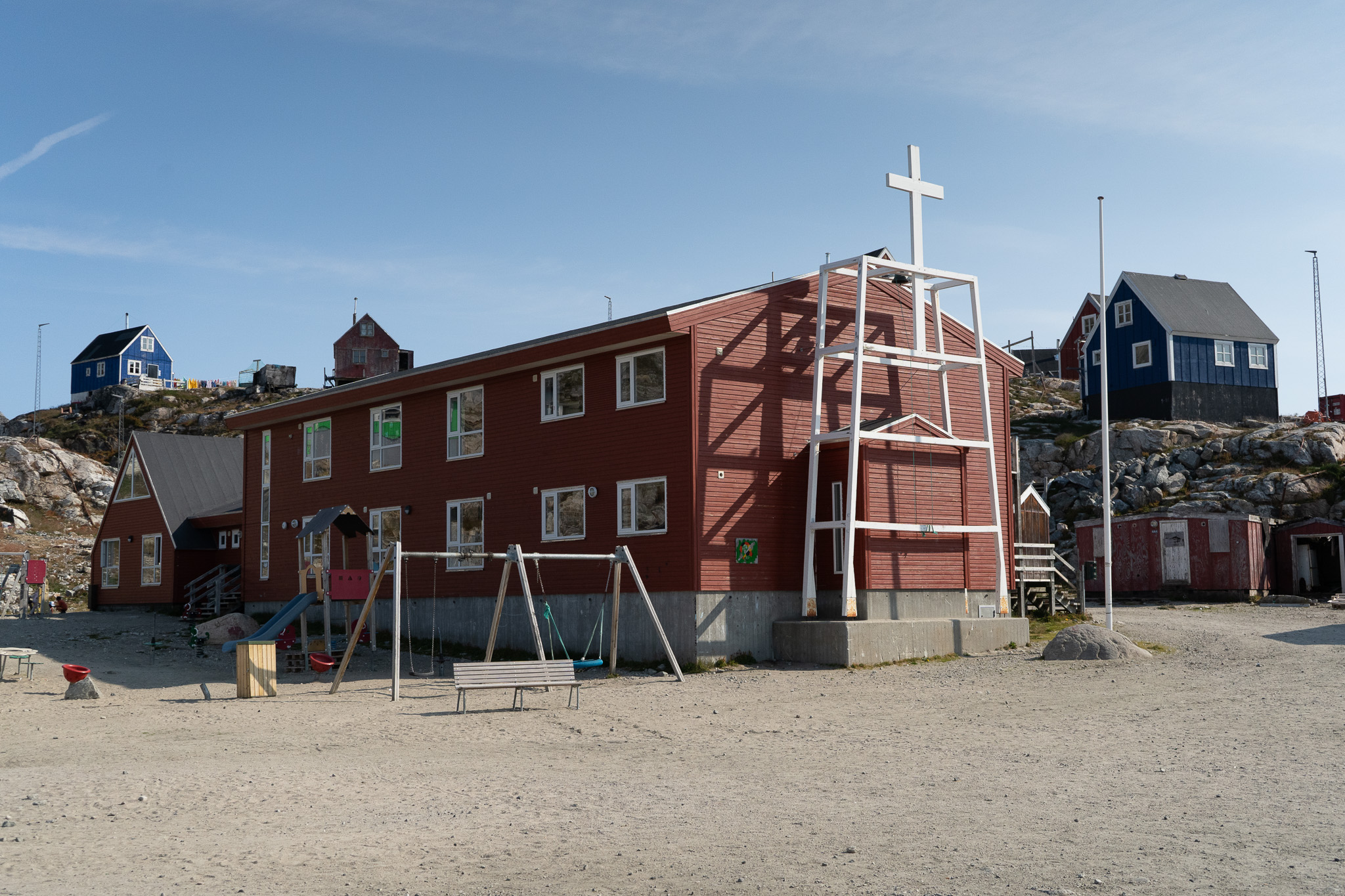
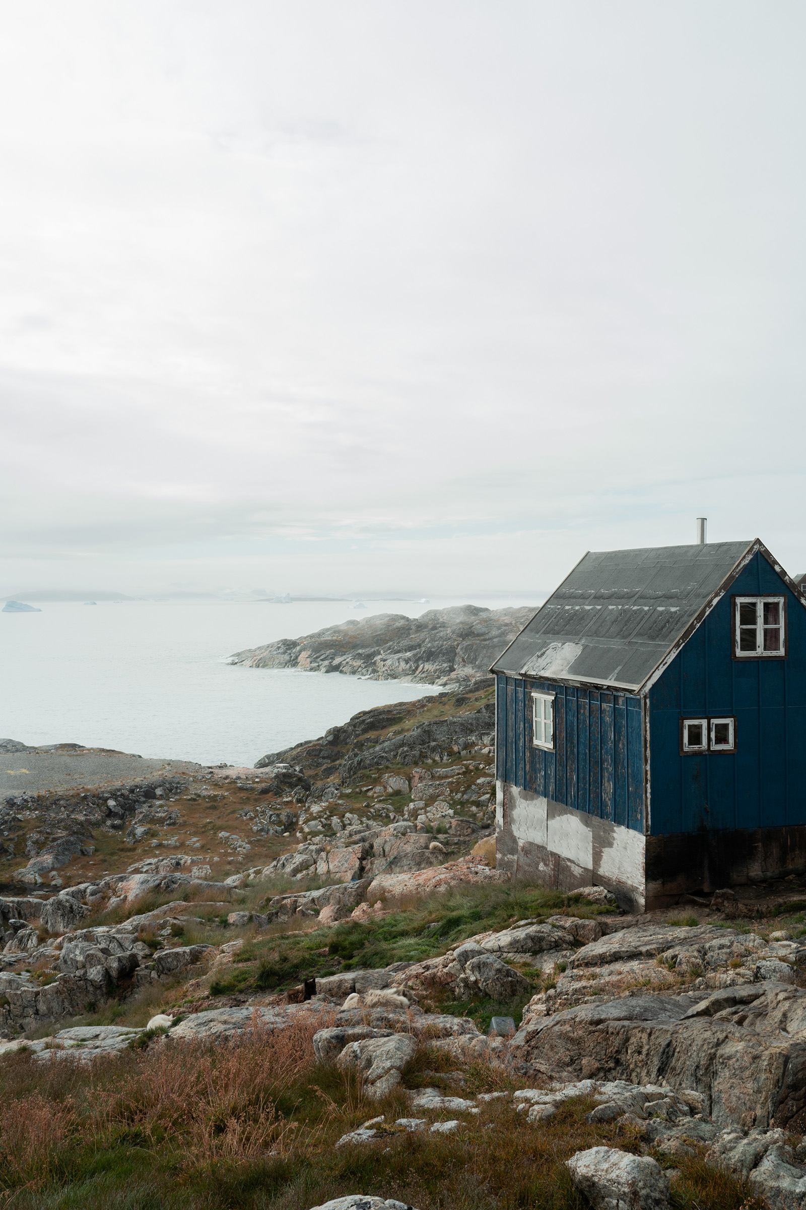
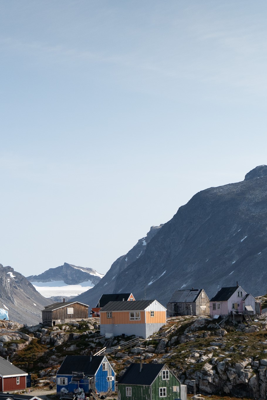
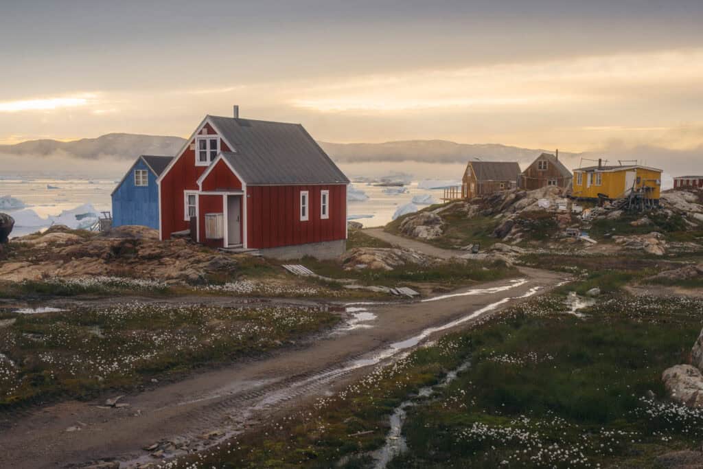
Tucked away in the northeastern part of the Ammassalik region, the small community of Sermiligaaq thrives in its remote yet serene setting. With a population of less than 200 residents, the settlement’s charm lies in its deep connection to the natural environment. Residents primarily rely on hunting and fishing, practices that have sustained them for generations. This connection to nature is woven into the daily life of the community, where traditional knowledge and skills are passed down and practiced with pride. The settlement is equipped with multi-purpose facilities, ensuring that all basic needs are met despite its isolation.
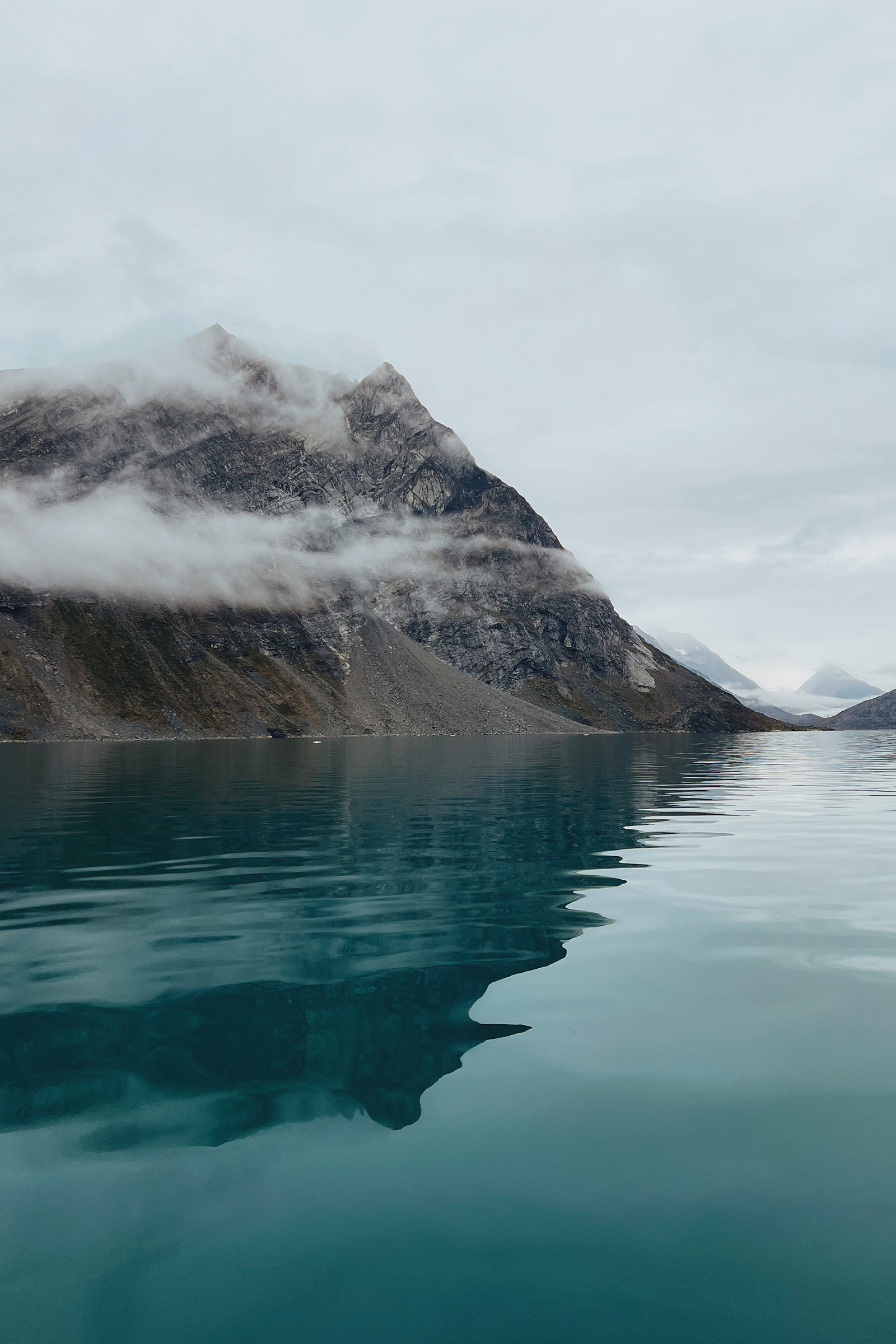
From Glaciers to Milky Blue Waters
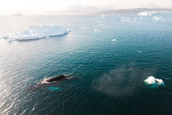
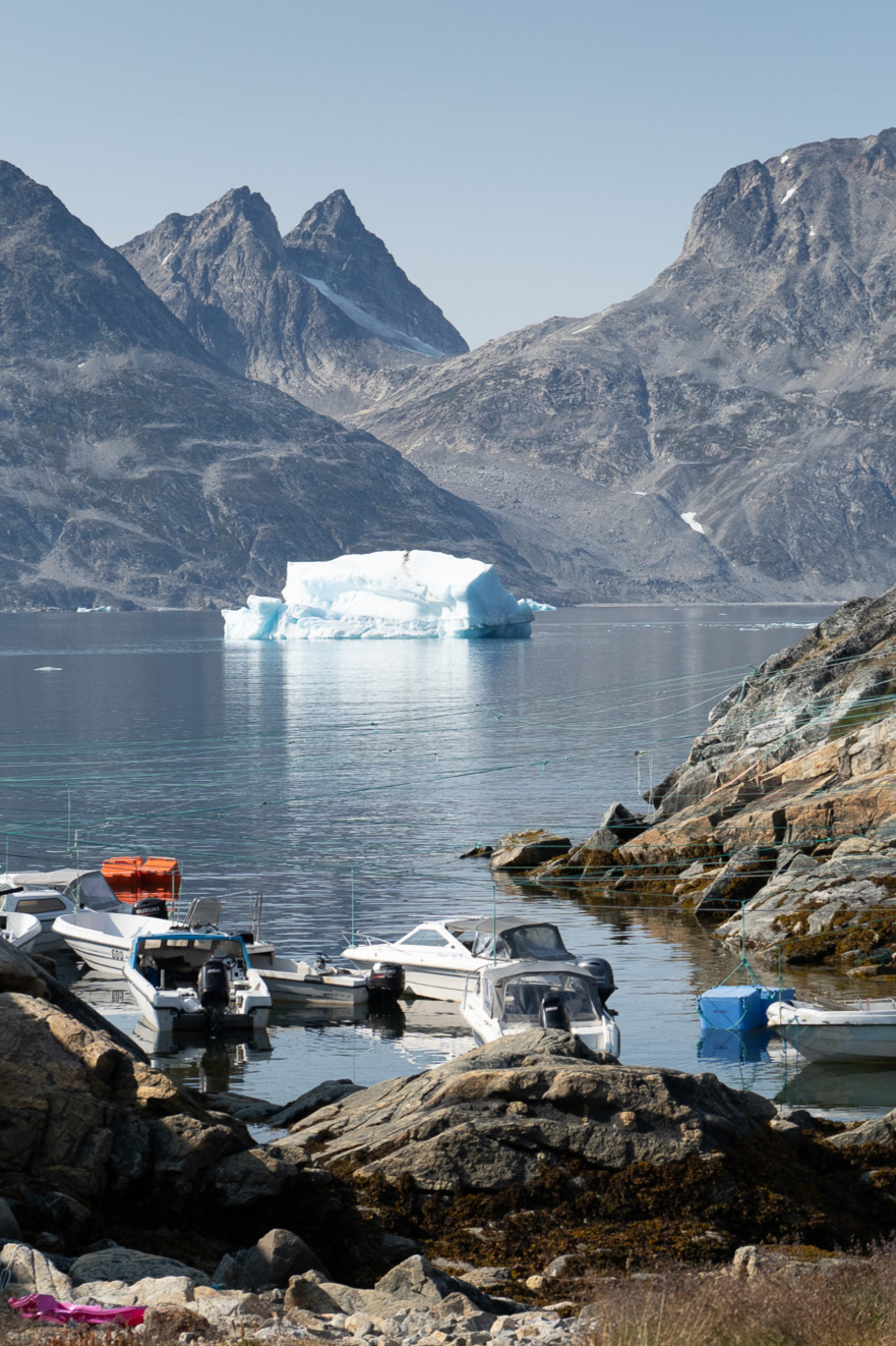
What sets Sermiligaaq apart is the stunning Sermiligaaq fjord, which is fed by the Knud Rasmussen and Kârale glaciers. This is also reflected in the name of the settlement and the fjord, which translates to the ‘beautiful glacier fjord’. Thanks to nearby glaciers like Knud Rasmussen Glacier and Kârale Glacier, the fjord boasts a mesmerising milky blue colour, a result of the sediments deposited by these glaciers. The water’s natural beauty is captivating – a spectacle that never fails to impress visitors. They are also a prime spot for wildlife such as whales, halibut and redfish.
Embrace the Spirit of Sermiligaaq
A visit to Sermiligaaq promises an unforgettable adventure. Immerse yourself in traditional Greenlandic life as you witness hunting and fishing firsthand, offering a glimpse into the daily rhythms of the local community. Be sure to explore the awe-inspiring glaciers and the strikingly beautiful, milky blue fjord.
Map of Sermiligaaq
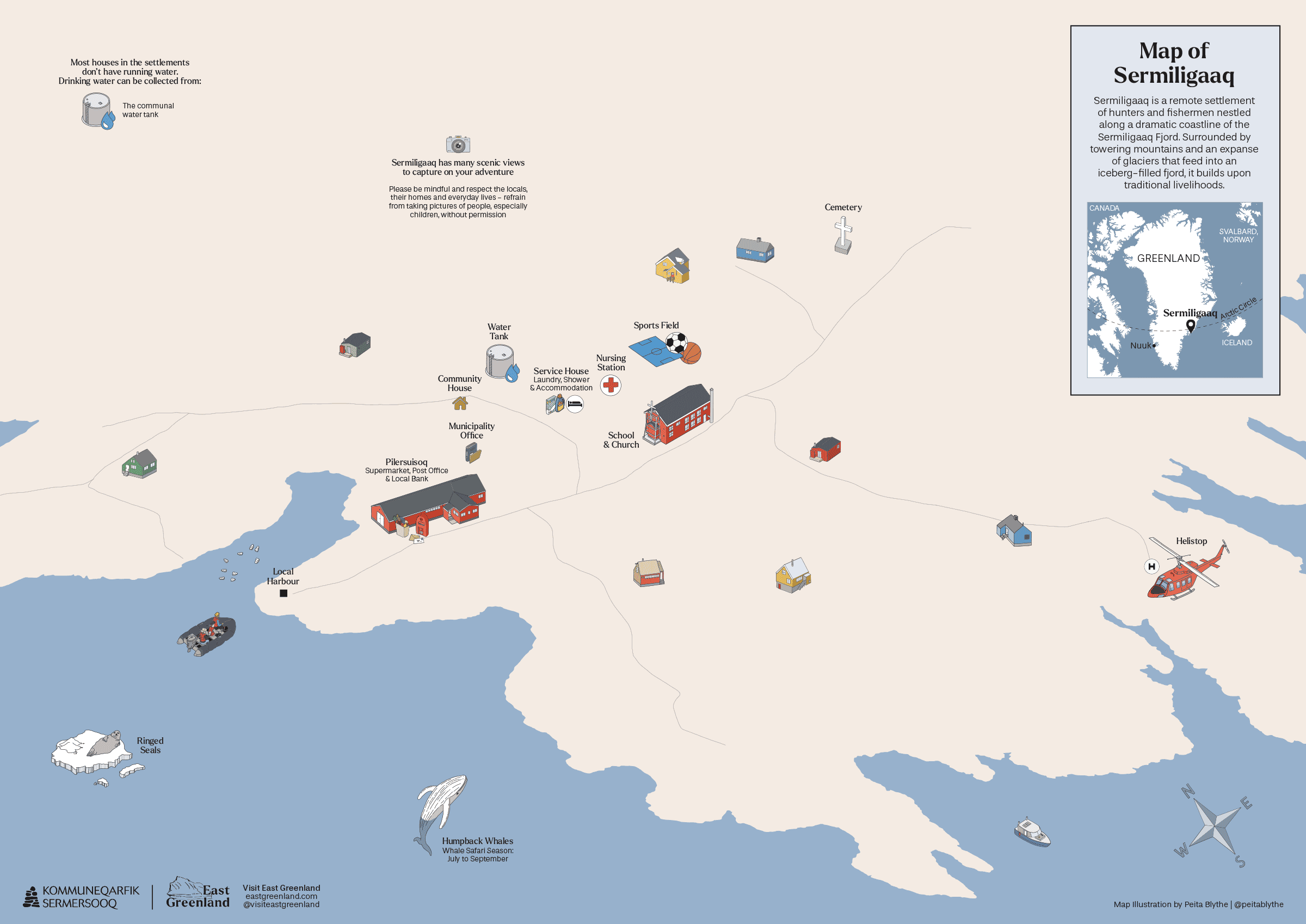
Explore the heart of East Greenland with our detailed Sermiligaaq map. Perfect for framing or as a travel companion, our illustrated maps will become your go-to guide!
Map of the Ammassalik Region
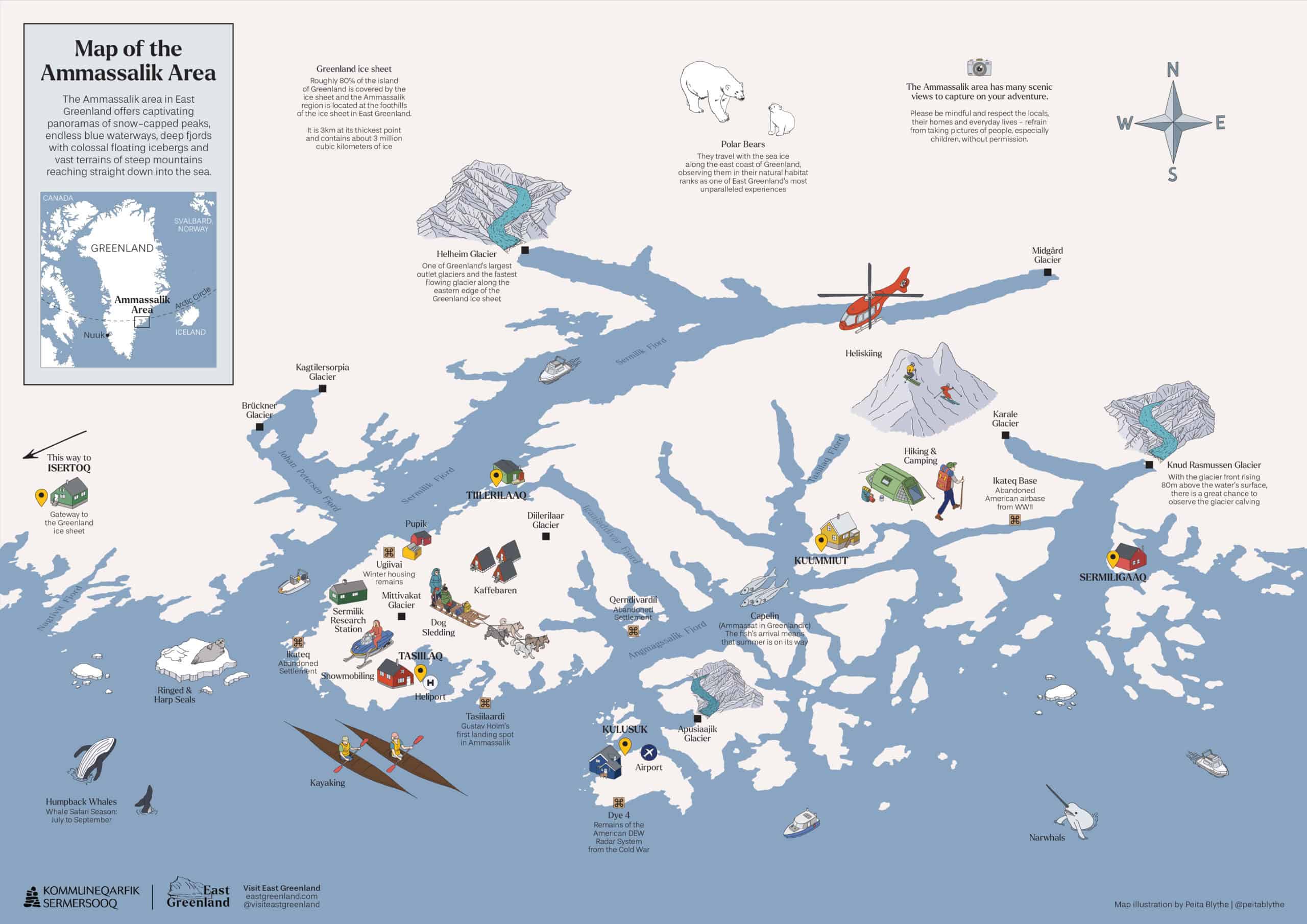
This map offers an expansive view of the region, helping you to plot your adventures and immerse yourself in the vastness and beauty of East Greenland.
Key Infrastructure in Sermiligaaq
- A helipad, a dedicated landing spot for the helicopter, check-in is handled by the supermarket.
- A harbour with local pontoon in the settlement
- A small supermarket that includes local Greenlandic bank and post office
- A petrol station that is managed by the supermarket and petrol must be purchased at the supermarket counter during their normal opening hours
- While there are no local providers based in Sermiligaaq, local operators can still arrange private day tours and assist with arranging private accommodations for visiting Sermiligaaq.
- A service house with running water that offers laundry and shower services, as well as basic accommodation facility
- Water supply: there is a communal silo in the centre of the settlement for collecting drinking water
- A nursing station that must be contacted for all medical inquiries
- Recreational facilities such as multipurpose football field
Articles about Sermiligaaq
Season Swap in East Greenland
Sled Dogs in East Greenland
Summer Adventures in East Greenland

Behind the Scenes of a Polar Bear and Muskox Expedition in Ittoqqortoormiit
Plan Your Trip
Plan your East Greenland adventure, tapping into local knowledge, expert tips, and essential planning tools.
Towns & Settlements
Explore East Greenland’s quaint towns and remote settlements, discovering unique landscapes, rich culture, and rugged Arctic beauty.
Tour Providers
Once you’ve chosen your adventure, book your East Greenland journey through local operators or plan it independently.
Articles
Read through our curated articles about East Greenland, deepening your insight into its seasons, traditions, and wonders.
Resources
Discover East Greenland’s essential resources and planning tools, ensuring deeper insights, trusted guidance, and a fulfilling adventure.